- ноември 4, 2018
- Објавено од: Град Скопје
- Категорија: News
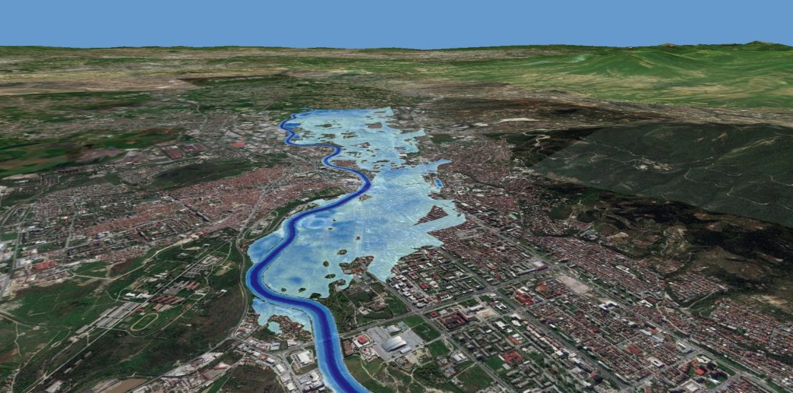
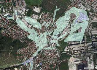
The City of Skopje conducted a “Flood Modelling Study for the City Of Skopje”, in accordance with the Flood Directive and the national regulations.
The key objectives of the study are:
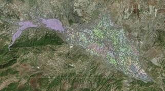
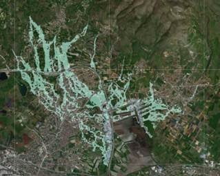
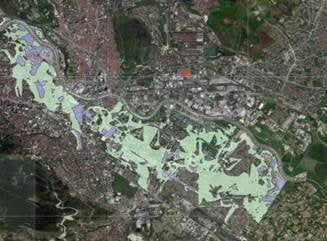
- To identify and map the existing and potential future flood hazard and risk areas within the Skopje City region, with an emphasis on the urban areas along the river Vardar
- То build a strategic information base necessary for making informed decisions in relation to managing flood risk in the area
- То identify viable structural and non-structural measures and options for managing flood risks for localized high-risk areas within the entire territory of the City.
The scenarios of possible flood waves are further visualized using the StoryMaps tool, and can be viewed on the following links:
SIMULATION OF EXTREME FLOODING FROM THE UPPER VARDAR RIVER AND DEMOLITION OF THE KOZJAK DAM
SIMULATION OF EXTREME FLOODS FROM 6 AUGUST 2016, SKOPSKA CRNA GORA
SIMULATION OF EXTREME FLOODING FROM THE UPPER VARDAR AND LEPENEC RIVERS
SIMULATION OF FLASHFLOODS FROM THE VODNO
The complete study on “Flood Modelling Study for the City Of Skopje” can be found here.
This study has been prepared within the ICT for Urban Resilience project, implemented with financial and technical support from the United Nations Development Programme. The flood modeling study was developed by PROPOINT Consulting while the visualized analyzes are prepared with the support of the City of Skopje Innovation Center – SkopjeLab using the StoryMaps tool.